
Running The Pemi Loop: A Trail Runner’s Dream Through the White Mountains

There are very few trail runs in the Northeast that match the sheer rugged beauty and challenge of New Hampshire’s Pemi Loop. At just over 30 miles with more than 9,000 feet of elevation gain, this loop isn’t just a long run—it’s a full-blown mountain adventure, and for trail runners who crave alpine ridgelines, steep climbs, and remote backcountry, this is definitely a run to consider.
I ran the loop on June 21, 2025. Had an absolute perfect weather window, so I had to take advantage!
What Is the Pemi Loop?
The Pemi Loop is a roughly 31-mile lollipop-style trail that circles the Pemigewasset Wilderness in New Hampshire. It connects eight 4,000-foot peaks—Flume, Liberty, Lincoln, Lafayette, Garfield, South Twin, Bond, and Bondcliff—with incredible views across the White Mountains almost the entire way. Most folks take two or three days to complete it by backpacking. For trail runners? It’s a test of endurance and grit.
The Run: A Play-by-Play

Mile 0–1.5: Lincoln Woods Trail to Osseo Trail Junction
The day starts on the deceptively smooth and flat Lincoln Woods Trail, a wide gravel path along an old railroad grade. It’s runnable, fast, and quiet—perfect for warming up the legs and easing into the day. It’s not very technical, so this made for easy ground to cover in the dark at 4am.
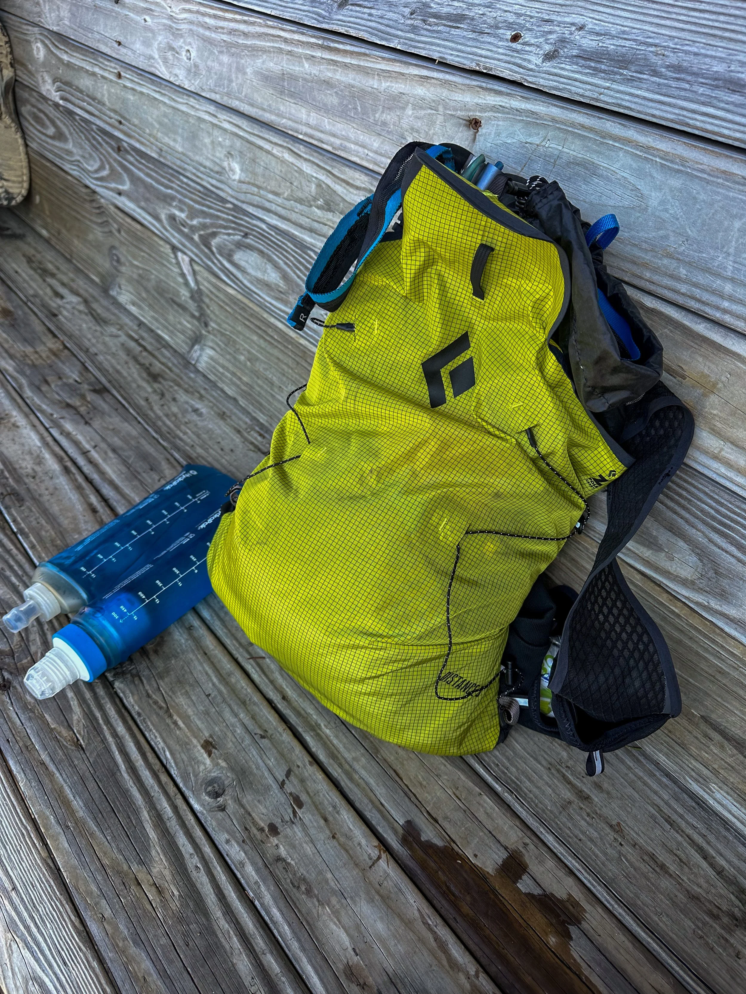
Quick Note: Once you make a left onto the Osseo Trail, this will be the last water source for almost 15 miles! Be sure to carry at least 2-3L depending on the temperatures that day!

Mile 1.5–5: Osseo Trail to Mount Flume (4,328 ft)
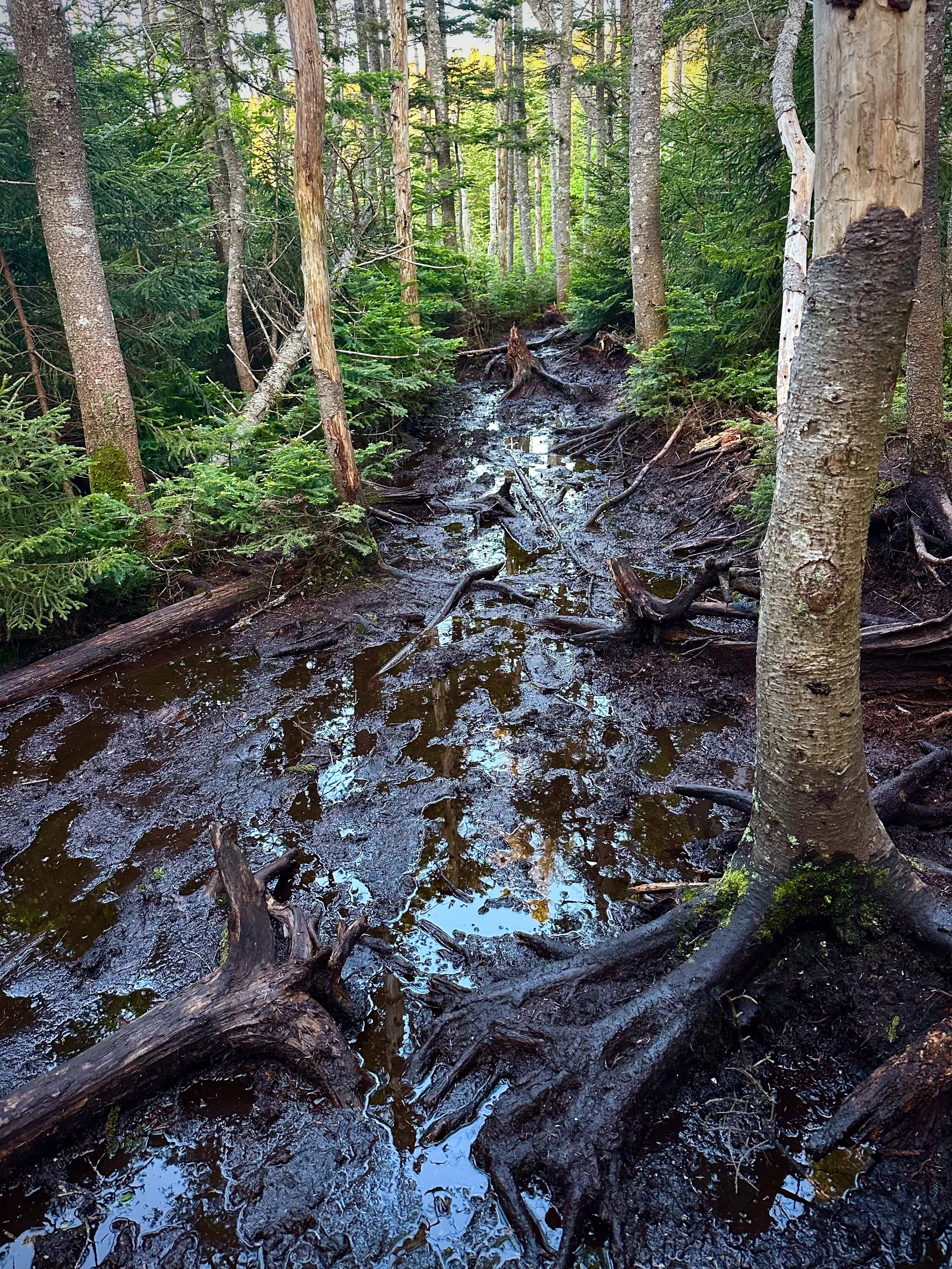
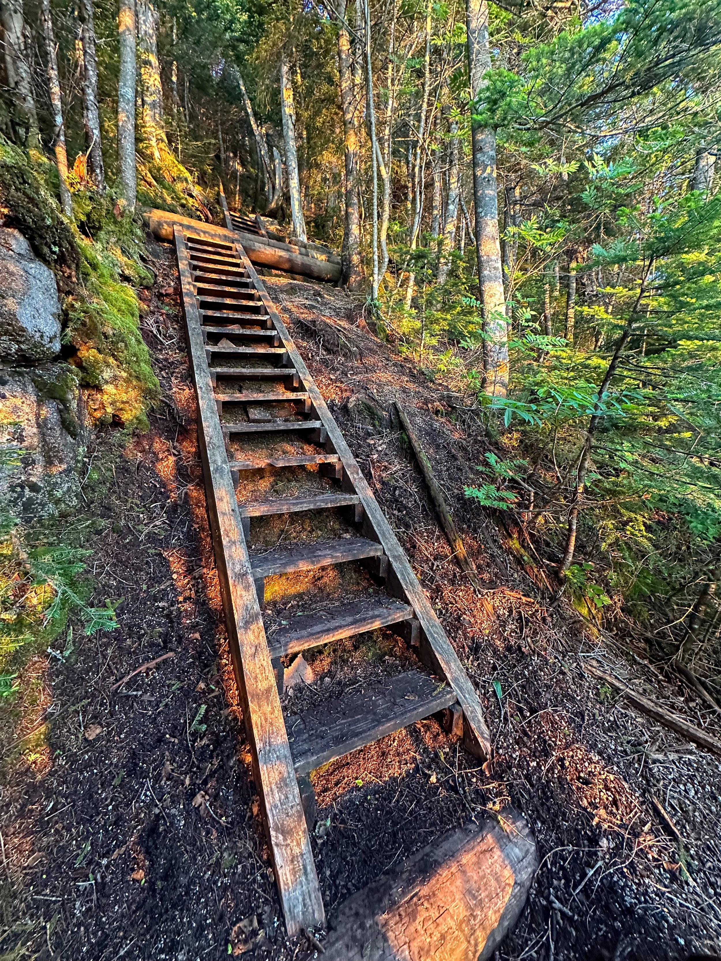
Once you make a left onto the Osseo Trail, things escalate quickly. The climb to Mount Flume is long and steady, winding through dense forest before giving way to wooden ladders bolted into the rock—classic White Mountains. There is where I began to experience the first bit of mud for the day. The views start opening up as you approach Flume’s exposed summit. This is your first major peak: Fantastic vistas of the Pemigewasset Wilderness behind you and Franconia Ridge stretching out in front of you.

Mile 5–6: Flume to Mount Liberty (4,459 ft)
From Flume, it’s a short ridge traverse to Mount Liberty. The path dips into the trees briefly before popping you out on Liberty’s open summit. These first two peaks often come with a cool morning breeze, as the sun has just risen by this time.

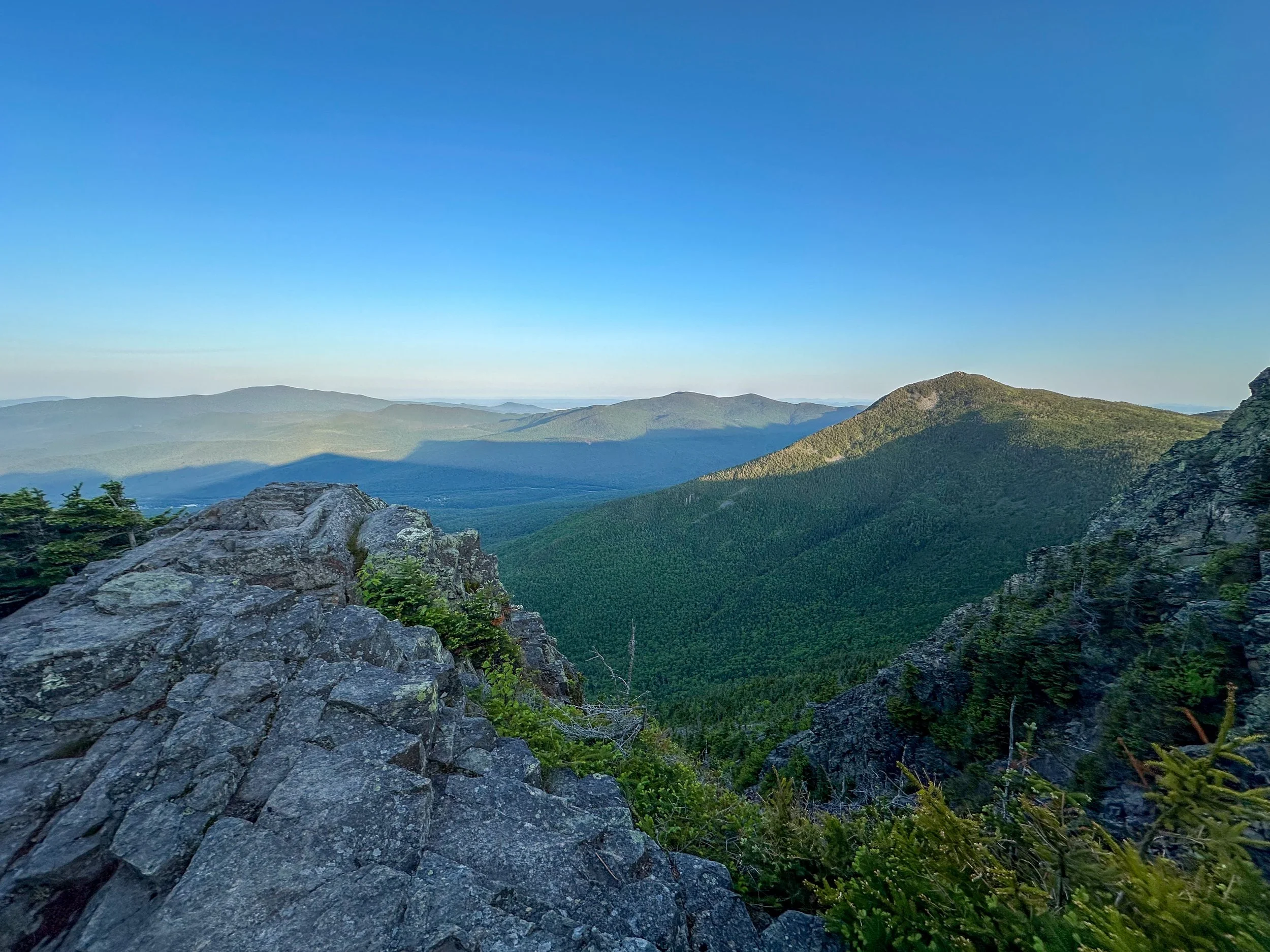
Mile 6–9.4: Franconia Ridge to Mount Lafayette (5,260 ft)
This is arguably the crown jewel of the loop. The Franconia Ridge Trail is high, exposed, and absolutely stunning. You’ll hit Little Haystack (not a 4,000-footer, but still prominent), then traverse the airy, open ridge to Mount Lincoln (5,089 ft), and finally the iconic Mount Lafayette, the highest peak on the loop. Enjoy this section!


Be warned: this stretch is often windy and weather-prone. Don’t linger too long—take in the views, snap a photo, and keep moving.
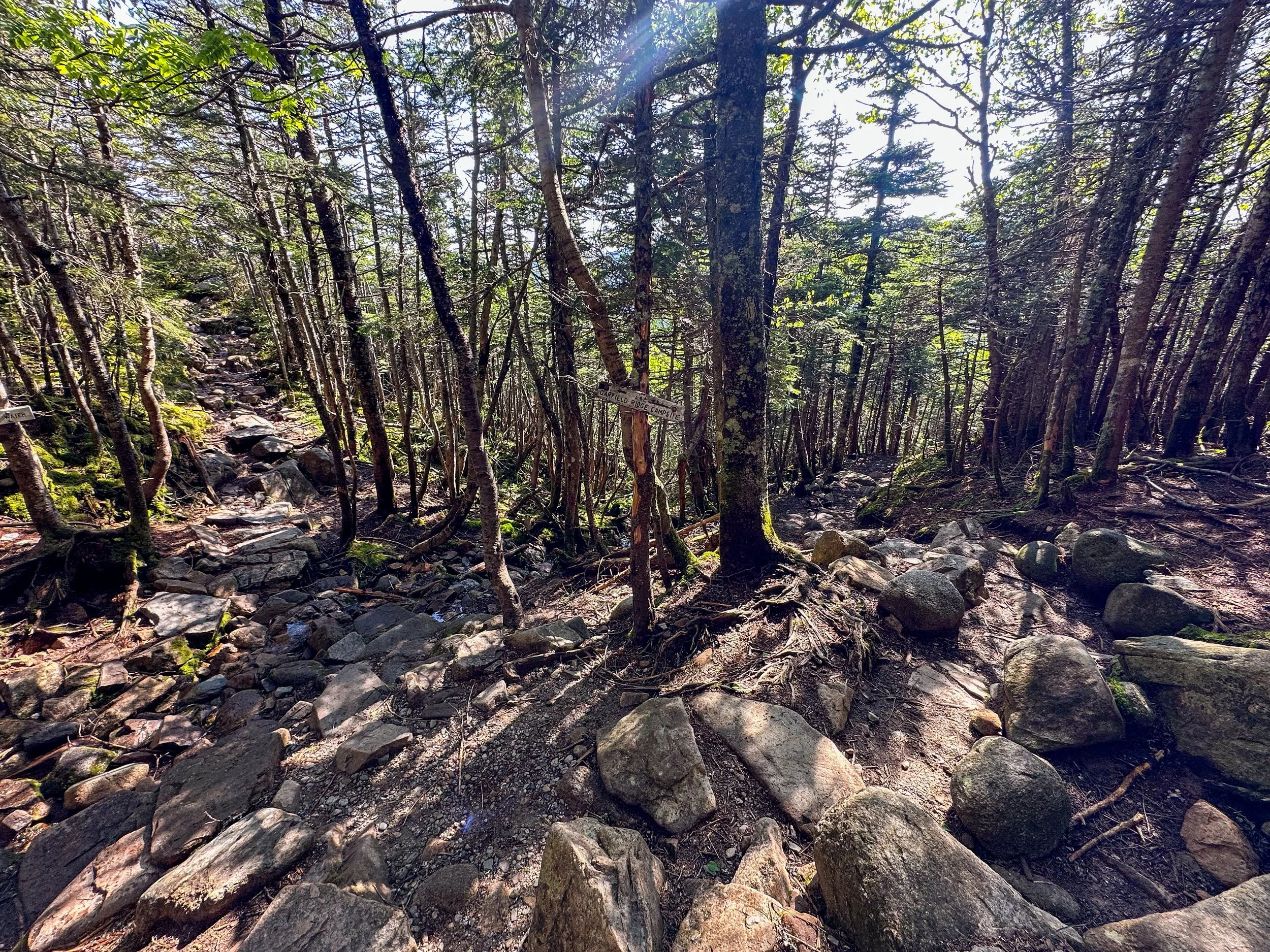
Mile 9.4–12.5 Lafayette to Garfield (4,500 ft)
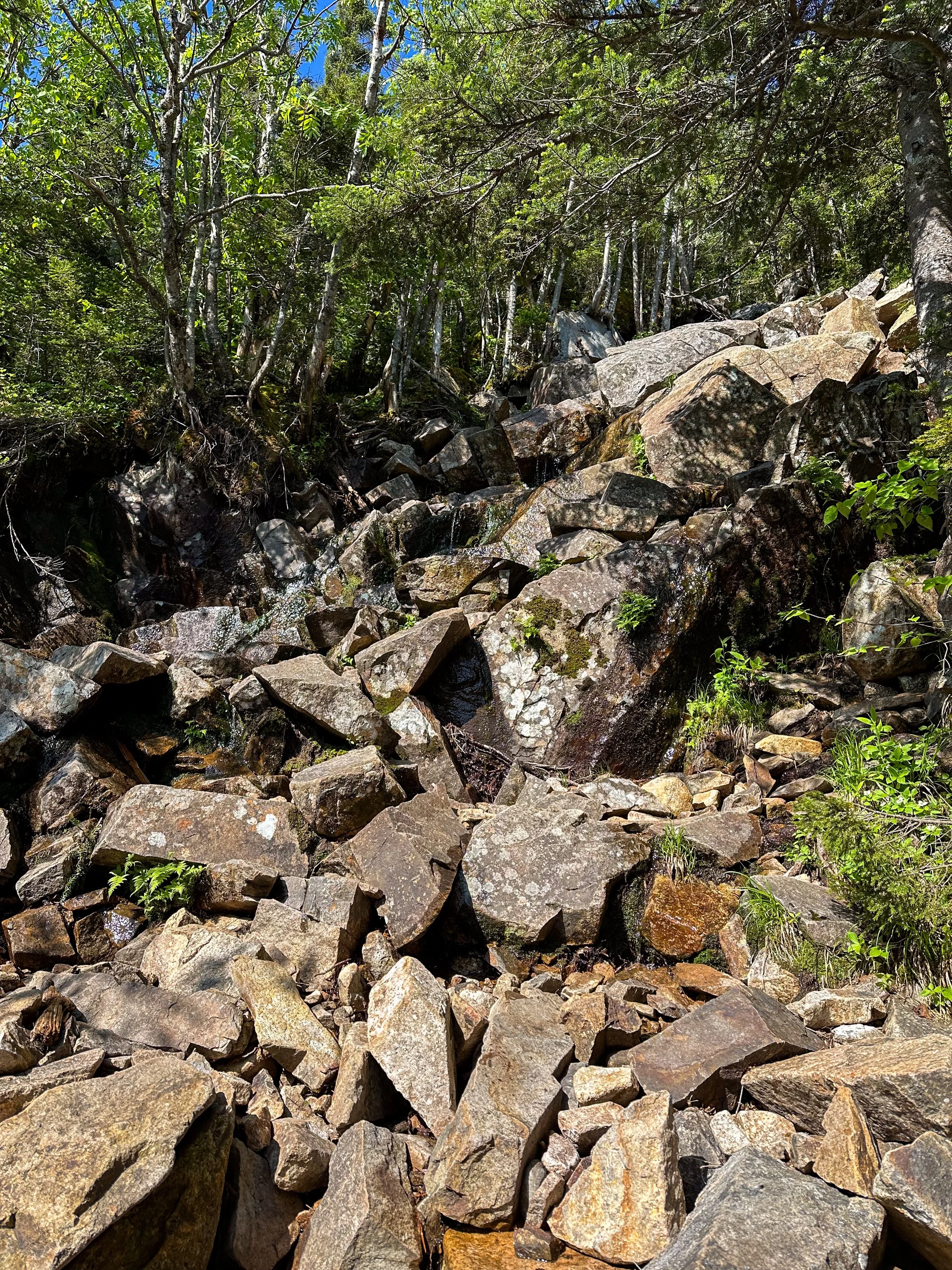
Now begins the descent off the ridge. The trail down Garfield Ridge is steep, rocky, and unforgiving—classic White Mountains terrain. Your quads will take a beating here. The trail briefly flattens before climbing sharply again to the summit of Mount Garfield. There’s an old fire tower foundation here and a full 360-degree view if the weather’s clear. It’s a good spot to refuel and mentally reset—you’re not even halfway.


Mile 12.5–14.5: Garfield to Galehead Hut
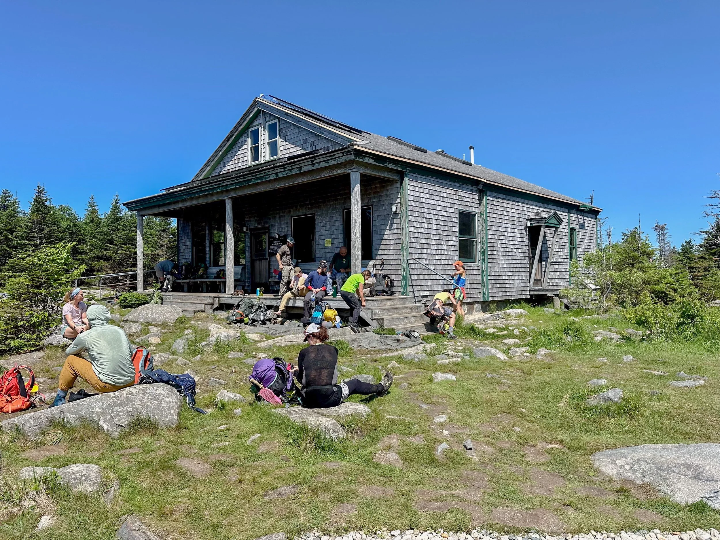
The descent from Garfield is rough and slick in places. You will eventually come to a creek during your descent. This is a fantastic spot to fill up on some water before getting to the hut. Carefully navigate wet rock slabs before reaching the saddle between Garfield and South Twin. Here lies Galehead Hut, an Appalachian Mountain Club hut that’s a great water refill stop and sometimes has leftover baked goods if you’re lucky. Enjoy lunch and the view! Just behind the hut is Galehead Mountain (a short out-and-back if you're peakbagging all 48 4,000-footers).

Mile 14.5–15.5: Climb to South Twin (4,902 ft)
This is widely considered the most brutal climb of the loop. The ascent from Galehead to South Twin is straight up—over 1,200 feet in just under a mile. It’s steep, rocky, and a total grind. But the summit is worth it: huge, open views and a feeling that you're deep into the wilderness now. It is quite hands-on at spots, so I put the trekking poles away for this section. It does go by quite fast though.

Mile 15.5–17.6: Twinway to Mount Guyot (4,580 ft)
The ridge from South Twin to Mount Guyot is fast and runnable in parts, with rolling terrain and occasional glimpses into the Pemigewasset. The trail twists through krummholz and open ledge sections before you top out on Guyot, a windswept alpine shoulder that feels more like something in the Rockies than the East Coast.


Mile 17.6–20.1: Guyot to Bond to Bondcliff
This stretch is the heart of the loop’s wildest terrain. First, you climb to Mount Bond (4,698 ft), which feels like the center of the wilderness. You’re far from everything here. After Bond, the trail begins its long, beautiful descent to Bondcliff (4,265 ft)—an exposed, photogenic ridgeline that’s often the highlight of the entire day. You’ll likely stop here, completely awestruck. The views are vast and unspoiled. Enjoy looking across at what you had run earlier that morning!


Mile 20.1–29.5: Bondcliff Trail to Lincoln Woods
The descent from Bondcliff is long—nearly 9 miles—and rugged at first. The upper section of Bondcliff Trail is rocky, technical, and slow-going. But as you drop lower, it becomes smoother and more runnable. Eventually, you rejoin Lincoln Woods Trail for the final few miles. The terrain is flat and easy, but after hours of mountain running, it can feel like it goes on forever. It felt great to be able to zone out and not have to worry about climbing boulders for the last bit!


Finish back at the Lincoln Woods trailhead, legs destroyed, heart full, and probably craving a beer.
Trail Running Tips for the Pemi Loop
Start early—like headlamp-early. You’ll want daylight for the best sections.
Bring plenty of food and water. There are refill options at Garfield Ridge Campsite and Guyot, but filter or treat.
Check the weather. The exposed ridges can turn gnarly fast—this is not a place to get caught in a storm.
Pace smart. The climbs are relentless. Walk the steep stuff, cruise the flats and downhills where possible. Even the flats and downhills are quite tough.
Know your exits. If something goes wrong, bailout points are few and far between. Definetly do your research ahead of time.
Final Thoughts
The Pemi Loop is more than a run. It’s a rite of passage for trail runners in the Northeast—a day that will leave you humbled, awestruck, and worked. You’ll carry the views, the sweat, and the sense of accomplishment for a long time. If you’re ready to test yourself against some of New England’s toughest terrain.